


Spatio-temporal Analysis on Urban Development and Scenario-based Flood Risk Assessment


Hiroyuki Miyazaki
Center for Spatial Information Science
Project Research Associate
※Faculty as of March 2024.
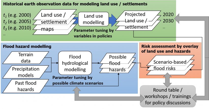
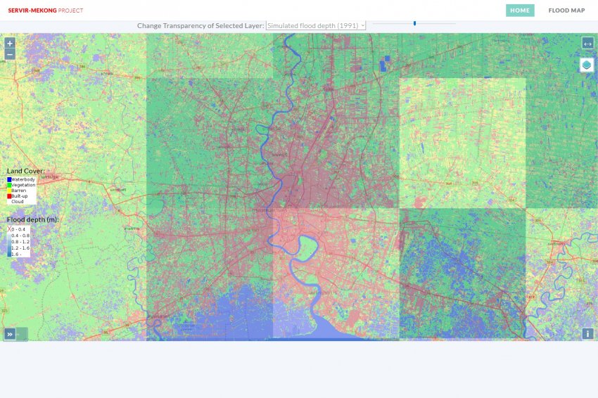
This project demonstrates the planning of spatial urban development for flood risk analysis targeting the area around the Greater Mekong Basin under the SERVIR Mekong Program by USAID and NASA. The project creates land-coverage and land-use maps using satellite data, overlays the data with flood models, and visualizes risk information using a spatial analysis tool for helping stakeholders in decision making. A pilot program is underway from July 2017 to March 2018.
Hiroyuki Miyazaki, the University of Tokyo
The Asian Institute of Technology
Related links
Research collaborators
- Sohee Kim, Asian Institute of Technology, Assistant Professor


