Find a book


Title
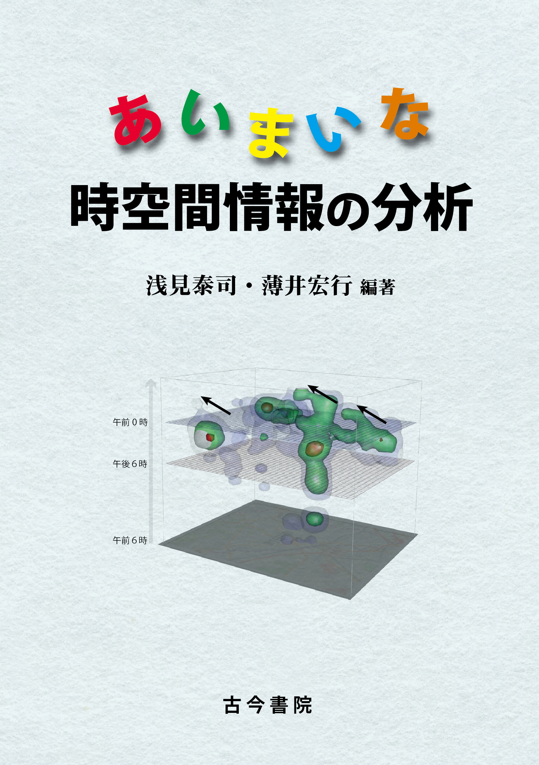
Aimai na Jikuukan Jyouhou no Bunseki (Vague Spatiotemporal Information Analysis)
Size
248 pages, A5 format
Language
Japanese
Released
December 15, 2020
ISBN
9784772220293
Published by
Kokon Shoin
Book Info
See Book Availability at Library
Japanese Page
The information we deal with in our daily lives is often tied to a place in one way or another. Even the Internet presents us with a large amount of “geographical information” consisting of “features” represented by points, lines, or polygons; “location information” about the features’ geographical position; and “attribute information” about the nature of the features, conveyed in the form of “spatiotemporal information”. Services using spatiotemporal information have been multiplying recently. We can say, therefore, that spatiotemporal information is becoming big data.
Geographical information systems (GIS) consist of software that can deal with geographical information. It used to employ a machine-centric system configuration which facilitates the machines’ understanding, but it has gradually evolved to a human-centric system which is friendlier to human beings. However, we cannot yet simply input our everyday language and thinking, as it is, in the software. This is because the geographical information we habitually use is often vague. The same can be said about temporal information. In our everyday life, we only communicate with pragmatic accuracy as seen in ‘Let’s meet in front of the ticket barriers of Shibuya Station around six o’clock tomorrow.’
However, most of the GIS packages are built on the premise that both location and temporal information is extremely accurate. It is difficult to deal with ‘around XXX’ as point information, and a circle drawn from an accurate point with a permitted range is often used instead. This means that, while there is a great need for “vague spatiotemporal information analysis” dealing with approximate locations (e.g., in front of the ticket barriers of Shibuya Station) and times (e.g., around six o’clock tomorrow without specifying morning or late afternoon), methods of dealing with vague spatiotemporal information effectively have yet to be developed.
The current volume brings together research findings and tool development outcomes regarding ‘vague spatiotemporal information’ pursued in the ‘Development and Application of next-generation tool box for analyzing temporal-spatial information’ (PI: ASAMI Yasushi), funded by a Grant-in-Aid for Scientific Research (A) in FY 2016-2020. The research project investigated how to analyze vague, inaccurate and ‘dirty’ spatiotemporal data.
We come across this kind of information in various places across history and geography. In the past, we did not have the technology or the habit to describe spatiotemporal information as accurately as we do now. Because of this, historical information is filled with this type of information. Even at the present time, the spatiotemporal information we use every day contains ambiguity.
This kind of ‘dirty’ spatiotemporal information is vague and because it is dependent on the analytical context, it is difficult to develop an analytical method that can be applied widely. We believe it is meaningful for researchers intent on engaging with vague spatiotemporal information analysis to bring knowledge and techniques developed by individual researchers into one place and to publish some of the methods as software. The current volume is a fruit of our efforts. The editors and contributors hope that the current volume would contribute to the development of vague spatiotemporal information analysis.
(Written by ASAMI Yasushi, Professor, School of Engineering, USUI Hiroyuki, Associate Professor, School of Engineering / 2022)