


PRESS RELEASES

Navigating underground with cosmic-ray muons New technology enables navigation in places GPS can’t reach Research news
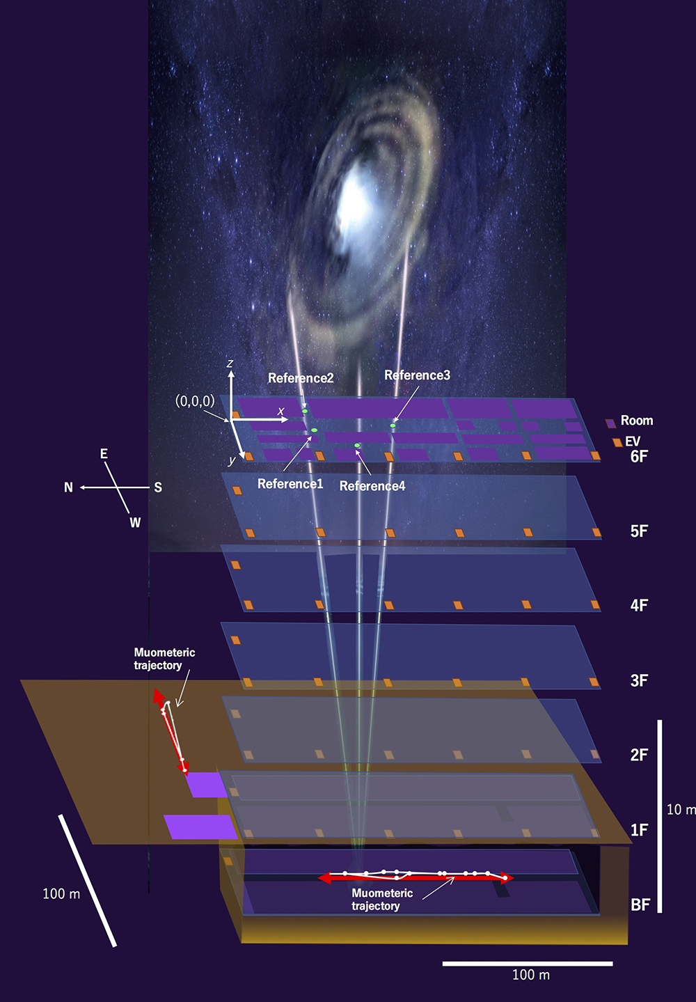
Navigating inside with muons. The red line in this image represents the path the “navigatee” walked, while the white line with dots shows the path recorded by MuWNS. ©2023 Hiroyuki K.M. Tanaka
Superfast, subatomic-sized particles called muons have been used to wirelessly navigate underground in a reportedly world first. By using muon-detecting ground stations synchronized with an underground muon-detecting receiver, researchers at the University of Tokyo were able to calculate the receiver’s position in the basement of a six-story building. As GPS cannot penetrate rock or water, this new technology could be used in future search and rescue efforts, to monitor undersea volcanoes, and guide autonomous vehicles underground and underwater.
GPS, the global positioning system, is a well-established navigation tool and offers an extensive list of positive applications, from safer air travel to real-time location mapping. However, it has some limitations. GPS signals are weaker at higher latitudes and can be jammed or spoofed (where a counterfeit signal replaces an authentic one). Signals can also be reflected off surfaces like walls, interfered with by trees, and can’t pass through buildings, rock or water.
By comparison, muons have been making headlines in recent years for their ability to help us look deep inside volcanoes, peek through pyramids and see inside cyclones. Muons fall constantly and frequently around the world (about 10,000 per square meter per minute) and can’t be tampered with. “Cosmic-ray muons fall equally across the Earth and always travel at the same speed regardless of what matter they traverse, penetrating even kilometers of rock,” explained Professor Hiroyuki Tanaka from Muographix at the University of Tokyo. “Now, by using muons, we have developed a new kind of GPS, which we have called the muometric positioning system (muPS), which works underground, indoors and underwater.”
MuPS was initially created to help detect seafloor changes caused by underwater volcanoes or tectonic movement. It uses four muon-detecting reference stations aboveground to provide coordinates for a muon-detecting receiver underground. Early iterations of this technology required the receiver to be connected to a ground station by a wire, greatly restricting movement. However, this latest research uses high-precision quartz clocks to synchronize the ground stations with the receiver. The four parameters provided by the reference stations plus the synchronized clocks used to measure the muons’ “time-of-flight” enables the receiver’s coordinates to be determined. This new system is called the muometric wireless navigation system (MuWNS).
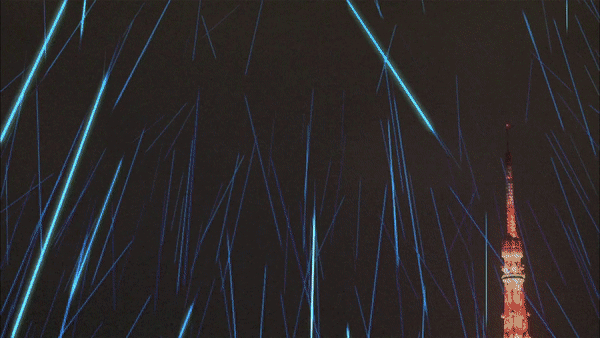
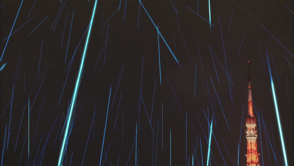
Artistic impression of muons showering the Earth. Muons exist for only 2.2 microseconds (one microsecond is just one-millionth of a second), but because they travel at the speed of light in a vacuum (300,000 kilometers per second), they have enough time to reach Earth from the atmosphere and penetrate deep into the ground. ©2015 Hiroyuki K.M. Tanaka
To test the navigation ability of MuWNS, reference detectors were placed on the sixth floor of a building while a “navigatee” took a receiver detector to the basement floor. They slowly walked up and down the corridors of the basement while holding the receiver. Rather than navigating in real time, measurements were taken and used to calculate their route and confirm the path they had taken.
“The current accuracy of MuWNS is between 2 meters and 25 meters, with a range of up to 100 meters, depending on the depth and speed of the person walking. This is as good as, if not better than, single-point GPS positioning aboveground in urban areas,” said Tanaka. “But it is still far from a practical level. People need one-meter accuracy, and the key to this is the time synchronization.”
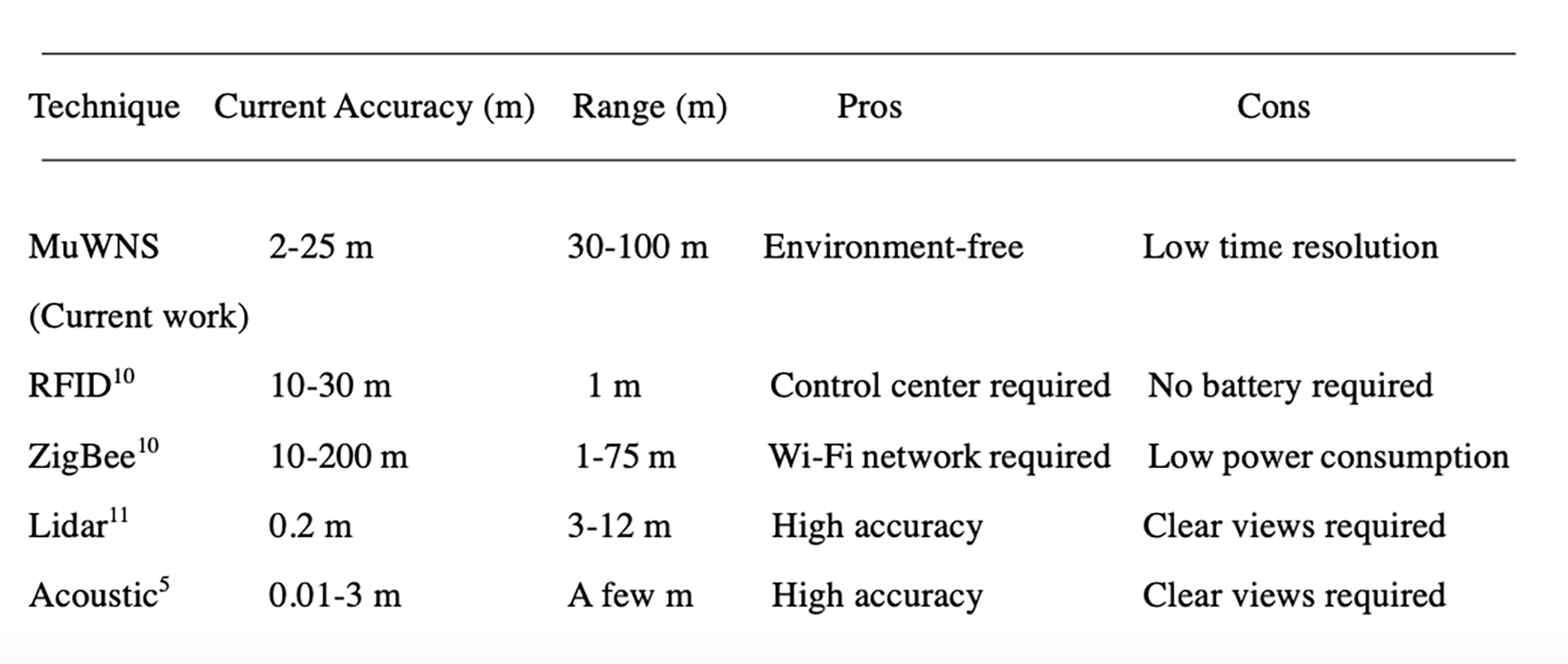
The pros and cons of alternative indoor and underground techniques. According to the researchers, when using MuWNS in an indoor or underground environment, it could achieve a higher accuracy compared to radio frequency identification (RFID) and Zigbee technologies, and a much broader range though much lower accuracy than lidar and acoustic navigation. ©2023 Hiroyuki K.M. Tanaka
Improving this system to enable real-time, meter-accurate navigation hinges on time and money. Ideally the team wants to use chip-scale atomic clocks (CSAC): “CSACs are already commercially available and are two orders of magnitude better than the quartz clocks we currently use. However, they are too expensive for us to use now. But, I foresee that they will become much cheaper as the global demand for CSAC for cellphones increases,” said Tanaka.
MuWNS could someday be used to navigate robots working underwater or guide autonomous vehicles underground. Aside from the atomic clock, all the other electronic components of MuWNS can now be miniaturized, so the team hopes that eventually fitting it into hand-held devices, like your phone, will be feasible. In emergency situations like a building or mine collapse, this may be a future game changer for search and rescue teams.
Papers
Hiroyuki K. M. Tanaka, Giuseppe Gallo, Jon Gluyas, Osamu Kamoshida, Domenico Lo Presti, Takashi Shimizu, Sara Steigerwald, Koji Takano, Yucheng Yang, Yusuke Yokota, "First navigation with wireless muometric navigation system (MuWNS) in indoor and underground environments," iScience: June 15, 2023, doi:10.1016/j.isci.2023.107000.
Link (Publication )
)
Related links
- Muographix
- muPS introductory video
- Related press release "Opening the eye of the storm"
- Related press release "Undersea detector proves it's swell"
- Related press release "Cosmic rays reveal tsunamis and waves"


