書籍検索
書籍検索


書籍名
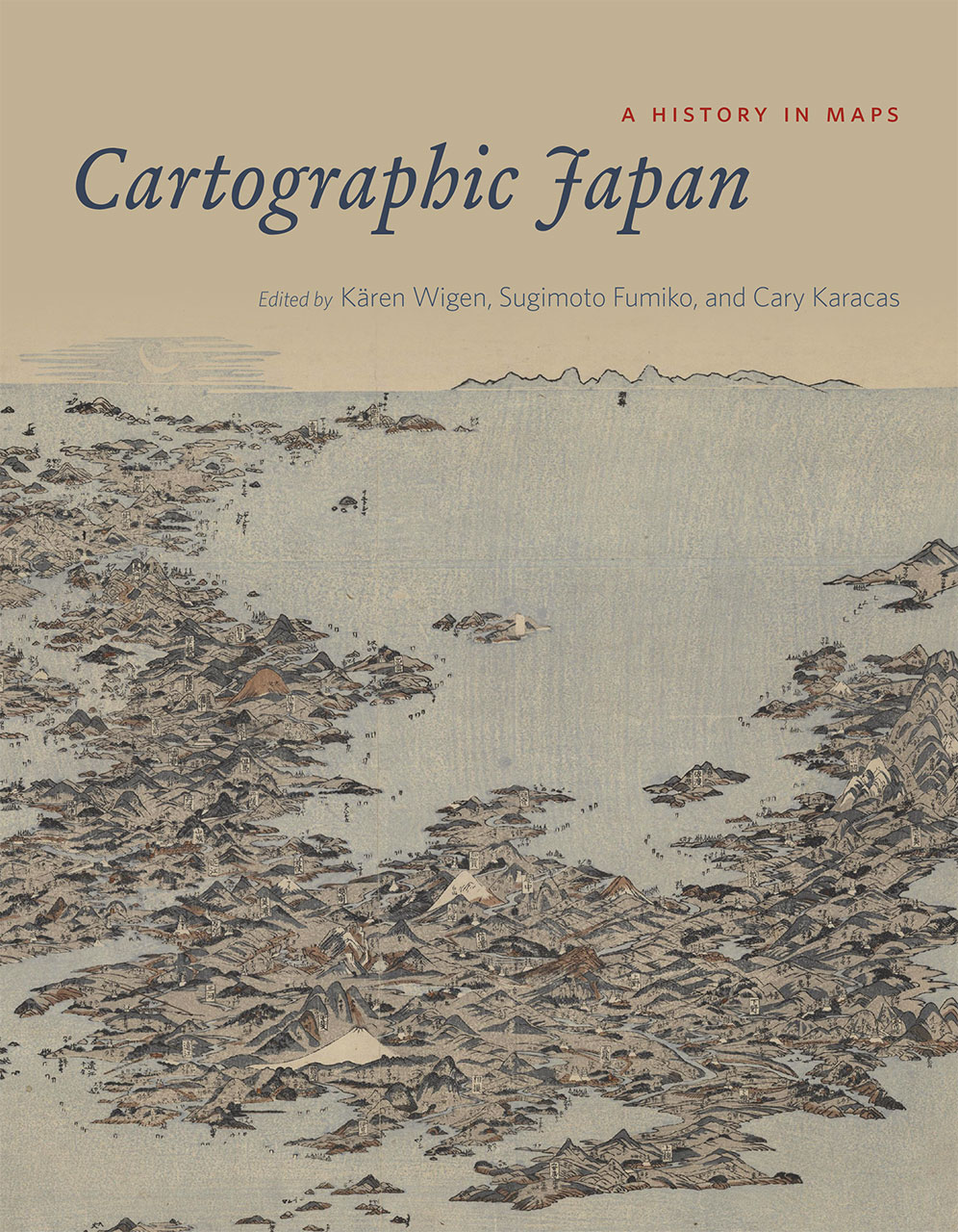
Cartographic Japan A HISTORY IN MAPS
判型など
336ページ、 8 1/2 x 11インチ
言語
英語
発行年月日
2016年3月
ISBN コード
9780226073057
出版社
The University of Chicago Press
出版社URL
学内図書館貸出状況(OPAC)
英語版ページ指定
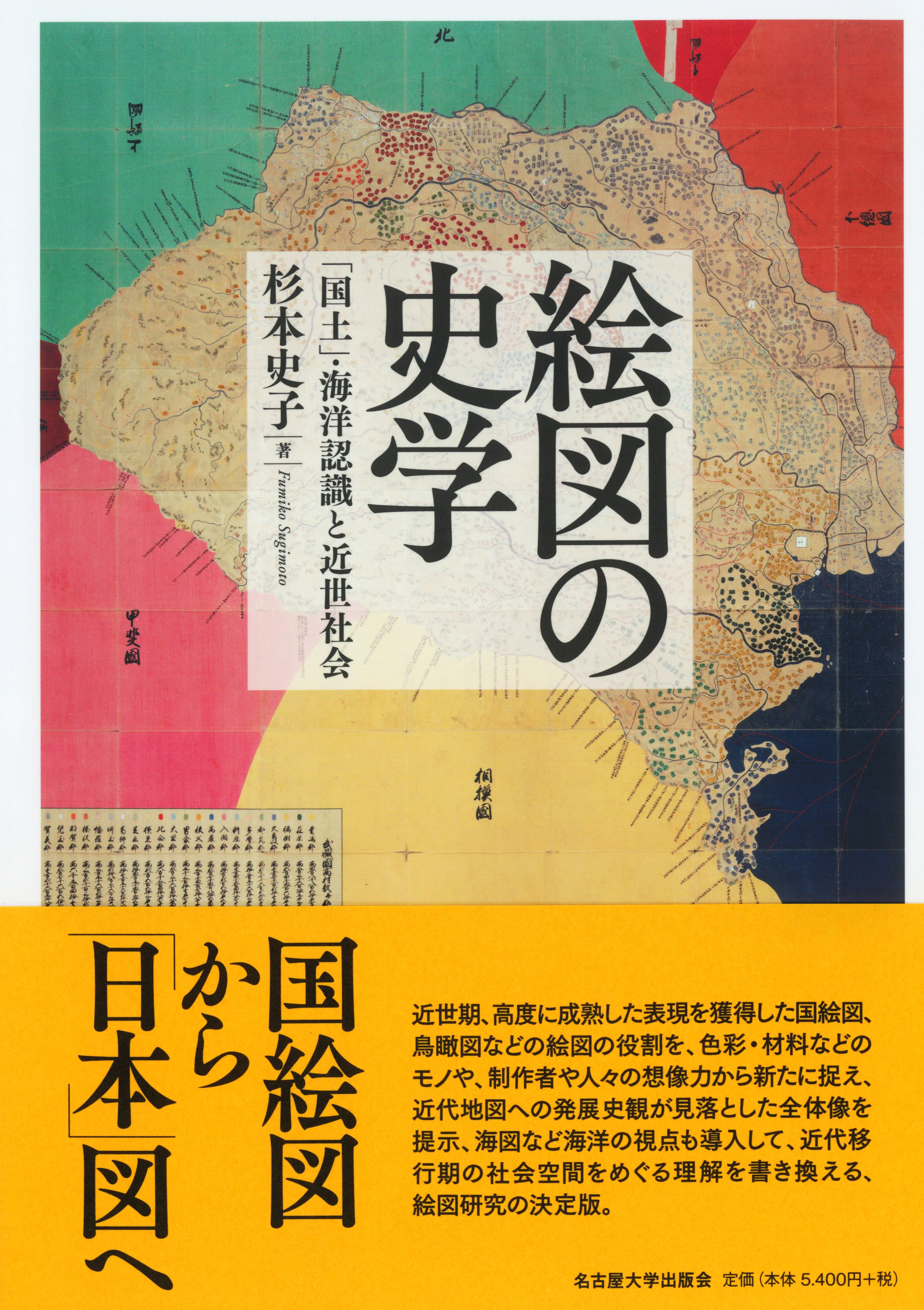
歴史をみるとき、自分をそのなかに置いてみるのか、それともその外側から観察するのか、その立ち位置によって、歴史のもつ意味は異なってくる。前者の場合、自分 (たち) が現在常識と考えている考え方や見方の意味の解明や、それを相対化し客観化するということに意義を置くことができるのに対し、後者は、純粋の分析対象として、自分とは切り離された異質の他者としてそれを扱うことが通常である。そこにはある種のエキゾチズムへの期待が潜んでいることもある。このズレを相互にどう理解し、相互対話を重ねていくか、そのことが、グローバル化する世界のなかで問われている。
本書は、16世紀から2011年東日本大震災までの「日本」およびそれをとりまく世界を描いた地図をとりあげ、日米欧の日本研究者たちが、「地図にあらわされた歴史 (本書の副題)」についてそれぞれ自分の分析を執筆したものである。執筆者それぞれバックグラウンドとする教養や常識は必ずしも同じではない。本書は、執筆者たちの視点が、歴史学だけではなく地理学、画家、文化財学、建築学、美術史家、文学、宗教学、情報学、科学史そして文化人類学、東アジア地域研究と、多岐の専門分野にわたっているだけでなく、「日本」のなかに住んでいる研究者と「日本」を外からみている研究者との共同論集という性格をもっている。現在の日本史を廻る研究状況は、日本語で発表される成果が英語で発表される成果とは別の独自の研究の流れをもっている。その背後には、近代 (modern) 以降に何次かにわたって行われた自治体による地域の膨大な史料の公開・活字化の動きがあり、またその背後には、近世 (early modern) 以来の「郷土史」といわれる地域の住民たちによる分たちの歴史や祖先の事跡の探求がある。そのような状況のなかでは、執筆者たちが前提とする研究史も一様ではない。
本書の特質は、このような研究状況にあって、各執筆者が随意に自分の「日本」に対する見方を披歴するのではなく、それぞれの時代に人々が描き出した地図を取り上げ、それを高精細の画像で紹介しながら、個々の歴史事象を論じていることにある。重要なことは、地図が、共同体の外側にいる人々に働きかけ、事態を理解してもらうために作成されるという基本的性格をもっていることである。狭い範囲の文化や価値観・考え方、そして日常の空間感覚を共有している人々の間では、地図は必ずしも必要ではない。口頭や文章で十分コミュニケーションすることが可能なのである。地図は、常識を共有しない他者に語りかけ、はたらきかけるためのツールといえる。地図を作った人々が彼らにとっての他者に対して、いかに自分の世界観や見方を語ろうとしようとしたか、そしてそれらの関係に対して、分析者としての自分の立ち位置はどこにあるのか。執筆者たちはこれらの地図を分析する作業を通じて、自分たちの立場の検証も迫られることになる。
本書がめざしたのは、地図作成からみた「日本」についてのひとつの固定した結論を提示することではなく、開かれた議論のためのプラットフォームの提供である。そしてさらに重要な本書の意義は、地図のもつこうした力を生かすことによって、「日本」をめぐる様々な時代の人々の見方と、「日本」をめぐる現在の最先端の研究の在り方を、研究者だけでなく、日本語圏以外の、一般の人々にも語りかけることを可能にしたことにある。
(紹介文執筆者: 史料編纂所 教授 杉本 史子 / 2017)
本の目次
Kären Wigen
I. Visualizing the Realm: Sixteenth to Eighteenth Centuries
Introduction to Part I
Sugimoto Fumiko
Japan in the World
1. Japan in a New-Found World
Joseph Loh
2. The World from the Waterline
Peter D. Shapinsky
3. Elusive Islands of Silver: Japan in the Early European Geographic Imagination
Oka Mihoko
4. Mapping the Margins of Japan
Ronald P. Toby
5. The Creators and Historical Context of the Oldest Maps of the Ryukyu Kingdom
Watanabe Miki
6. The Introduction of Dutch Surveying Instruments in Japan
Satoh Ken’ichi
7. The European Career of Ishikawa Ryusen’s Map of Japan
Marcia Yonemoto
8. A New Map of Japan and Its Acceptance in Europe
Matsui Yoko
Domestic Space
9. The Arms and Legs of the Realm
Constantine N. Vaporis
10. Visualizing the Political World through Provincial Maps
Sugimoto Fumiko
11. Fixing Sacred Borders: Villagers, Monks, and Their Two Sovereign Masters
Sugimoto Fumiko
12. Self-Portrait of a Village
Komeie Taisaku
II. Mapping for the Market
Introduction to Part II
Kären Wigen
Mapping the City
13. Characteristics of Premodern Urban Space
Tamai Tetsuo
14. Evolving Cartography of an Ancient Capital
Uesugi Kazuhiro
15. Historical Landscapes of Osaka
Uesugi Kazuhiro
16. The Urban Landscape of Early Edo in an East Asian Context
Tamai Tetsuo
17. Spatial Visions of Status
Ronald P. Toby
18. The Social Landscape of Edo
Paul Waley
19. What Is a Street?
Mary Elizabeth Berry
Sacred Sites and Cosmic Visions
20. Locating Japan in a Buddhist World
D. Max Moerman
21. Picturing Maps: The “Rare and Wondrous” Bird’s-Eye Views of Kuwagata Keisai
Henry D. Smith II
22. An Artist’s Rendering of the Divine Mount Fuji
Miyazaki Fumiko
23. Rock of Ages: Traces of the Gods in Akita
Anne Walthall
24. Cosmology and Science in Japan’s Last Buddhist World Map
Sayoko Sakakibara
Travelscapes
25. Fun with Moral Mapping in the Mid-Nineteenth Century
Robert Goree
26. A Travel Map Adjusted to Urgent Circumstances
Kären Wigen and Sayoko Sakakibara
27. Legendary Landscape at the Kitayama Palace
Nicolas Fiévé
28. New Routes through Old Japan
Roderick Wilson
III. Modern Maps for Imperial Japan
Introduction to Part III
Cary Karacas
Defining the Borders
29. Seeking Accuracy: The First Modern Survey of Japan’s Coast
Suzuki Junko
30. No Foreigners Allowed: The Shogunate’s Hydrographic Chart of the “Holy” Ise Bay
Suzuki Junko
31. Indigenous Knowledge in the Mapping of the Northern Frontier Regions
Tessa Morris-Suzuki
32. Mamiya Rinzo and the Cartography of Empire
Brett L. Walker
33. Outcastes and Peasants on the Edge of Modernity
Daniel Botsman
Transforming the Cityscape
34. Converging Lines: Yamakawa Kenjiro’s Fire Map of Tokyo
Steven Wills
35. Mapping Death and Destruction in 1923
J. Charles Schencking
36. Rebuilding Tokyo after the Great Kanto Earthquake
André Sorensen
37. Shinjuku 1931: A New Type of Urban Space
Henry D. Smith II
Managing an Empire
38. Mapping the Hojo Colliery Explosion of 1914
Brett L. Walker
39. Cultivating Progress in Colonial Taiwan
Philip C. Brown
40. Showcase Thoroughfares, Wretched Alleys: The Uneven Development of Colonial Seoul (Keijo)
Todd A. Henry
41. Imperial Expansion and City Planning: Visions for Datong in the 1930s
Carola Hein
42. A Two-Timing Map
Catherine L. Phipps
43. Visions of a New Order in the Asia-Pacific
David Fedman
IV. Still under Construction: Cartography and Technology since 1945
Introduction to Part IV
Kären Wigen
Up from the Ashes
44. Blackened Cities, Blackened Maps
Cary Karacas and David Fedman
45. The Occupied City
Cary Karacas
46. Sacred Space on Postwar Fuji
Andrew Bernstein
47. Tange Kenzo's Proposal for Rebuilding Hiroshima
Carola Hein
48. Visions of the Good City in the Rapid Growth Period
André Sorensen
Growing Pains in a Global Metropolis
49. On the Road in Olympic-Era Tokyo
Bruce Suttmeier
50. Traversing Tokyo by Subway
Alisa Freedman
51. The Uses of a Free Paper Map in the Internet Age
Susan Paige Taylor
52. Tsukiji at the End of an Era
Theodore C. Bestor
New Directions in the Digital Age
53. Probabilistic Earthquake Hazard Maps
Gregory Smits
54. Citizens’ Radiation Maps after the Tsunami
Jilly Traganou
55. Run and Escape!
Satoh Ken’ichi
56. Postmortem Cartography: “Stillbirths” and the Meiji State
Fabian Drixler
57. Reconstructing Provincial Maps
Nakamura Yusuke
58. The Art of Making Oversize Graphic Maps
Arai Kei
Epilogue
Sugimoto Fumiko
関連情報
Choice Magazine: CHOICE Outstanding Academic Title Awards