


My City Report for road managers

- 2.6 Big Data Analysis Technologies
- 2.7 Open Data Infrastructure Technologies
- 3.5 Spatial Information (Remote Sensing, Environmental Monitoring, COVID-19 Countermeasures)
- 3.6 Edge Computing Applications
- 3.7 Data Applications
- 3.8 Smart City, City Operating Systems
- 5.3 Market Verification, Evidence Based Policy Making (EBPM)
- 5.6 Digital Government/Local Government
- 7.1 Digital Transformation (DX) in Society
Yoshihide Sekimoto
Center for Spatial Information Science
Professor Institute of Industrial Science Project Professor
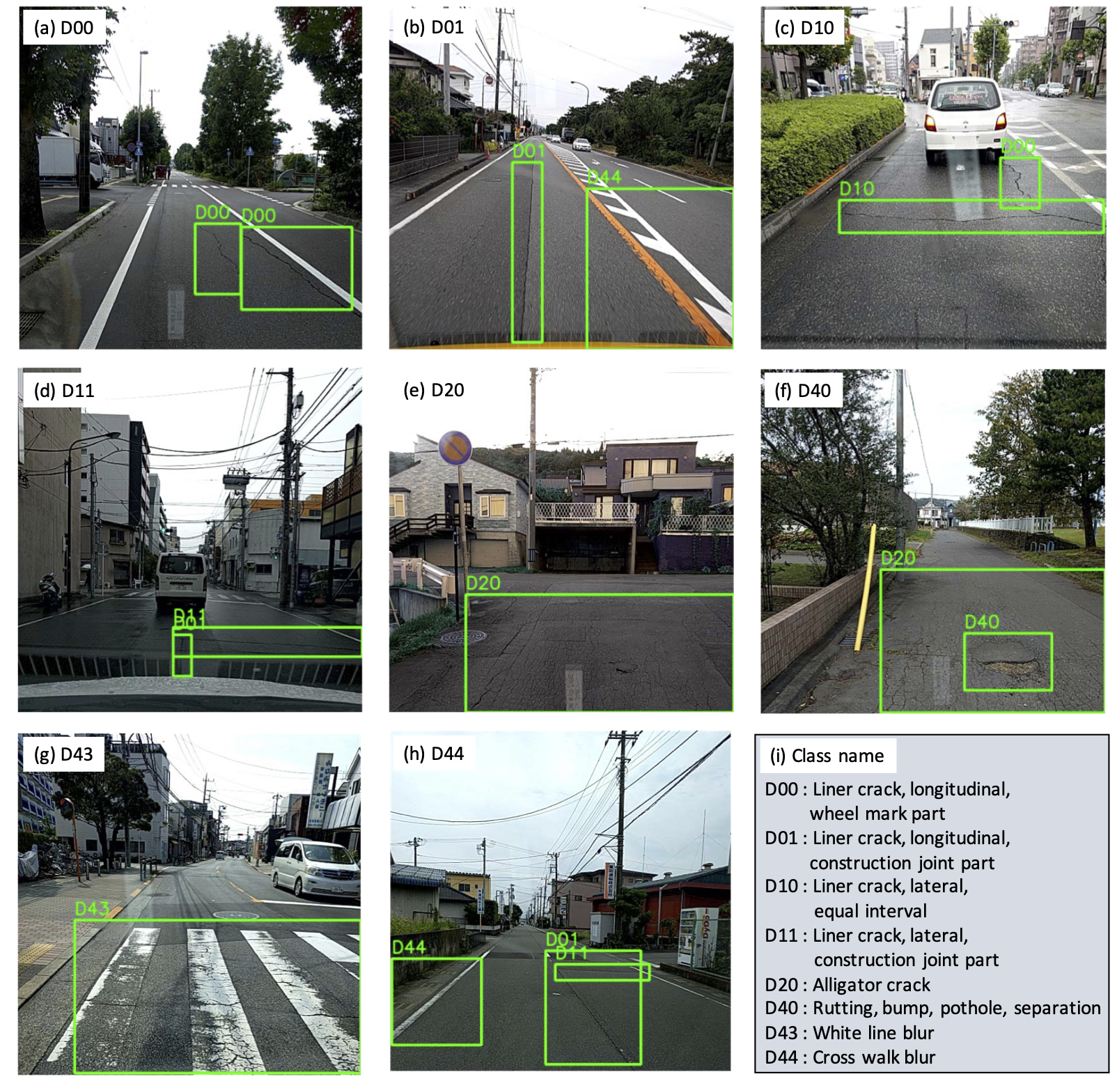
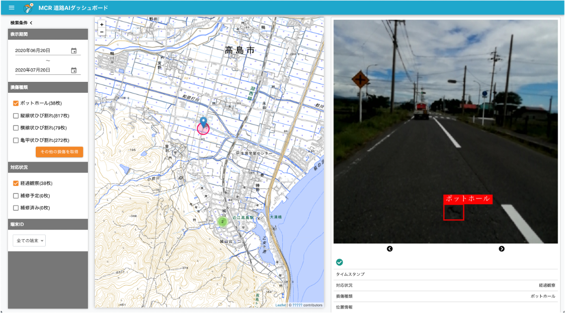
By collecting road images using smartphones (or driving recorders) mounted on vehicles and detecting road damages by emerging AI techniques, the My City Report for road managers project aims to comprehensively capture at comprehensively real-time grasping the road damage situation in real-time and optimizing optimize the efficiency of inspections operation. As the component of the My City Report consortium, this project launched and provided services in 13 municipalities with MCR for citizens (a civic collaboration contribution service) .
Sekimoto Laboratory, the University of Tokyo
Sekimoto Laboratory, the University of Tokyo
Related links
Research collaborators
- Urban X Technologies, Inc.
- Association for Promotion of Infrastructure Geospatial Information Distribution
Related publications
- Maeda, H., Sekimoto, Y., Seto, T., Kashiyama, T. and Omata, H., Generative adversarial network for road damage detection, Computer-Aided Civil and Infrastructure Engineering, Wiley, Vo.36, pp.47-60, Available online 2 June 2020.
- Maeda, H., Sekimoto, Y., Seto, T., Kashiyama, T., & Omata, H. (2018). Road damage detection and classification using deep neural networks with smartphone images. Computer‐Aided Civil and Infrastructure Engineering, 33(12), 1127-1141.
- 前田紘弥, 関本義秀, 瀬戸寿一, 樫山武浩, 小俣博司, 機械学習とスマートフォンを用いた道路の損傷画像のリアルタイム検出と修繕対応基準における各特徴量の重要度比較, 交通工学論文集, 2018, 4 巻, 3 号, p. A_1-A_8
Related patents
Patent number 2019-139316
SDGs


Contact
- Sekimoto Lab. (CSIS & IIS)
- Email: sekimoto[at]csis.u-tokyo.ac.jp
※[at]=@


