


Integrated Land Simulator for Improvement of Climate Prediction

- 2.8 Global Environment (Natural Resource Management, Climate Change, Database for Global Environment)
Kei Yoshimura
Institute of Industrial Science
Professor
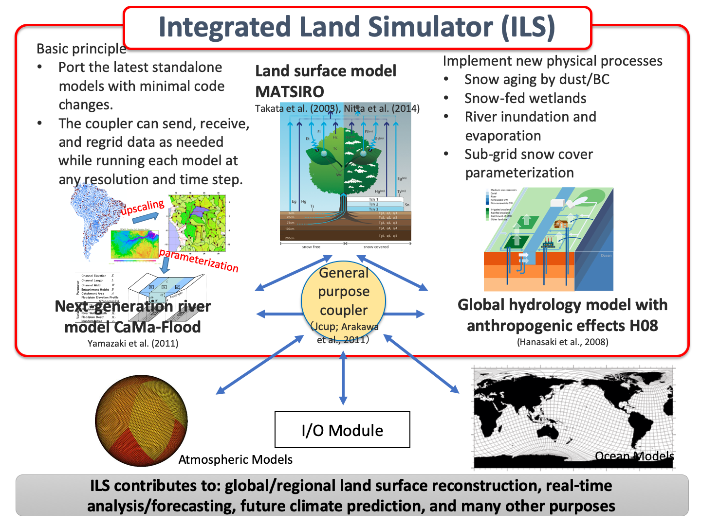
To provide the lower terrestrial boundary conditions for the latest Earth system models, we will develop a terrestrial model that can represent the entire globe with grids at horizontal-distance intervals of 1 km. In addition, we will use the latest satellite data and GIS technology to develop and maintain boundary conditions, such as those on soil type, surface roughness, and land-use data at a 1-km resolution, which are necessary to implement such a terrestrial model. Processes that are important for a more detailed spatio-temporal scale (e.g., slope runoff processes and groundwater use) will be incorporated into the model as new parameterizations. Through these efforts, we will be able to achieve more accurate climate predictions and help assess the impact of climate change in more detail, meeting the needs of society.
Related links
Research collaborators
・Tomoko Nitta, Yukihiko Onuma, Dai Yamazaki (The University of Tokyo)
・Yukiko Hirabayashi (Shibaura Institute of Technology)
・Yukiko Hirabayashi (Shibaura Institute of Technology)
Related publications
Nitta, T., T. Arakawa, M. Hatono, A. Takeshima, K. Yoshimura(cor), Development of Integrated Land Simulator, Prog. Earth Planet. Sci., 7, 68, 2020.
SDGs

Contact
- Research Management Office, Institute of Industrial Science
- ex. 56747
- Email: rmo[at]iis.u-tokyo.ac.jp
※[at]=@


