


Digital Twin Construction Platform “Re:Earth”

- 1.4 Visualization, Visual Analytics
- 1.5 Data Sharing, Data Co-Creation (Search, Data Linkage, Data Authoring. Meta-data Creating)
- 2.5 Geospatial Information (Remote Sensing, People Flow)
- 2.14 Education (E-Learning, Educational Contents, Remote Education, Learning Management)
- 2.15 Humanities(Religion, Literature, Linguistics, History, Archeology, Cultural Anthropology, Geography, Area Studies, Tourism, Museology, Art, etc)
Hidenori Watanave
Interfaculty Initiative in Information Studies and Graduate School of Interdisciplinary Information Studies
Professor
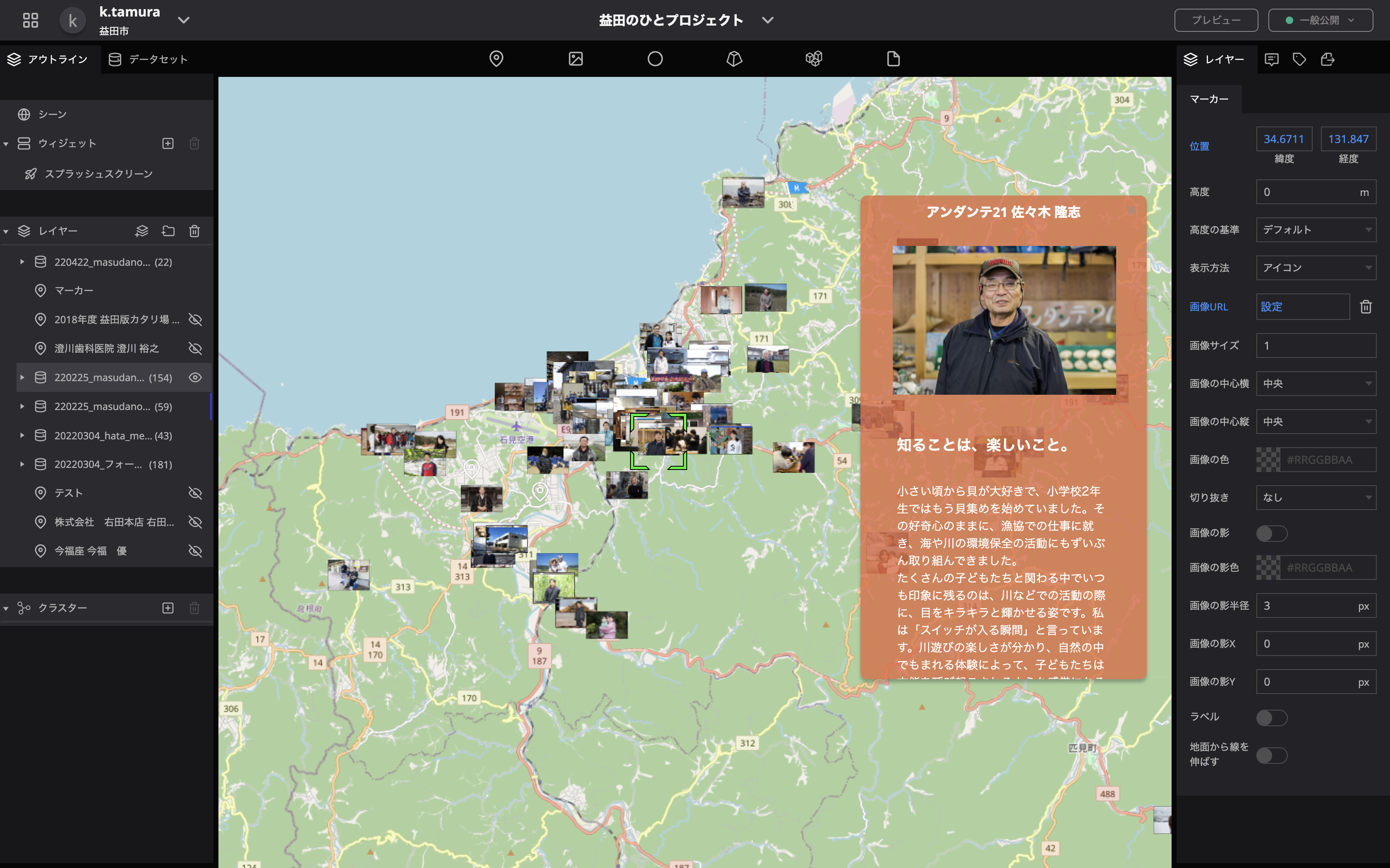
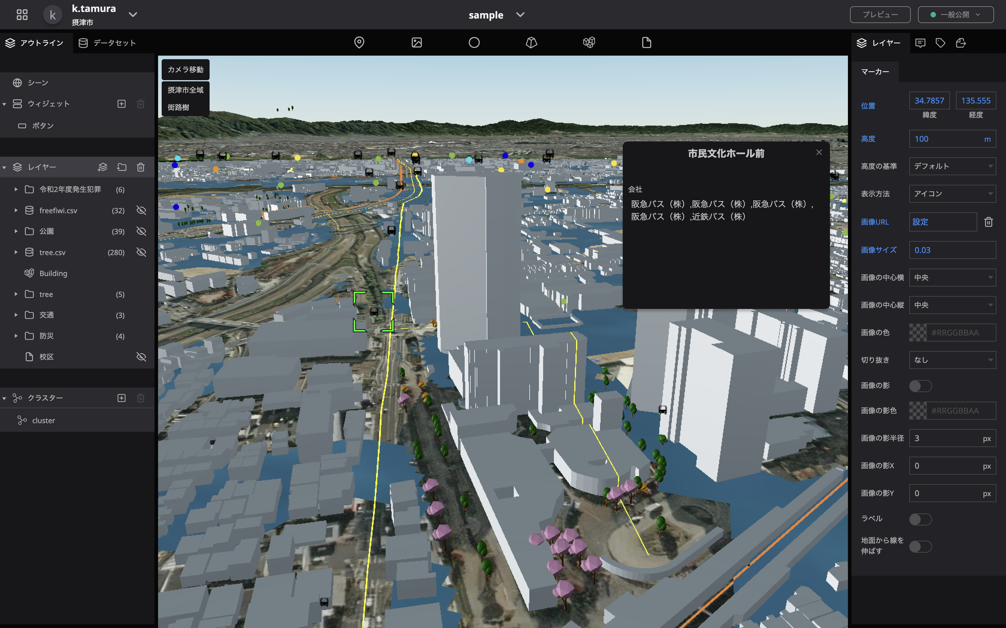
“Re:Earth” is a WebGIS platform that serves as the foundation for a “digital twin” that reproduces information from physical space in virtual space. The source code that forms the basis of the digital twin has been released as open-source software to enable its free use in a variety of fields.
【features of re:earth】
【features of re:earth】
- Providing an easy-to-use environment for utilizing geospatial (physical space) data, which is becoming increasingly complex and large-scale.
- Realization of a general-purpose WebGIS for management, analysis, and visualization of geospatial data
- Expansion of functions through the development of plug-ins for various fields “Re:Earth” is developed using the latest Web technology, enabling users to easily access a full-fledged GIS environment from anywhere without the need for installation, which has been difficult to achieve with Web browsers. By making it open source, we plan to form a worldwide OSS community with engineers from all over the world, including developers of the main unit and plug-ins.
Watanave Lab.
Watanave Lab.
Related links
Research collaborators
Eukarya Co., Ltd.
SDGs
Contact
- Email: hwtnv[at]iii.u-tokyo.ac.jp
※[at]=@


