


Satellite Images Map of Ukraine

- 1.4 Visualization, Visual Analytics
- 1.5 Data Sharing, Data Co-Creation (Search, Data Linkage, Data Authoring. Meta-data Creating)
- 2.5 Geospatial Information (Remote Sensing, People Flow)
- 2.7 Disaster Prevention, Reconstruction (Earthquake, Tsunami, Volcano, Meteorology, Flood, Natural Disaster)
- 2.12 Social Science (Digital Archive, Social Investigation, Sociology, Economics, Social Informatics)
Hidenori Watanave
Interfaculty Initiative in Information Studies and Graduate School of Interdisciplinary Information Studies
Professor
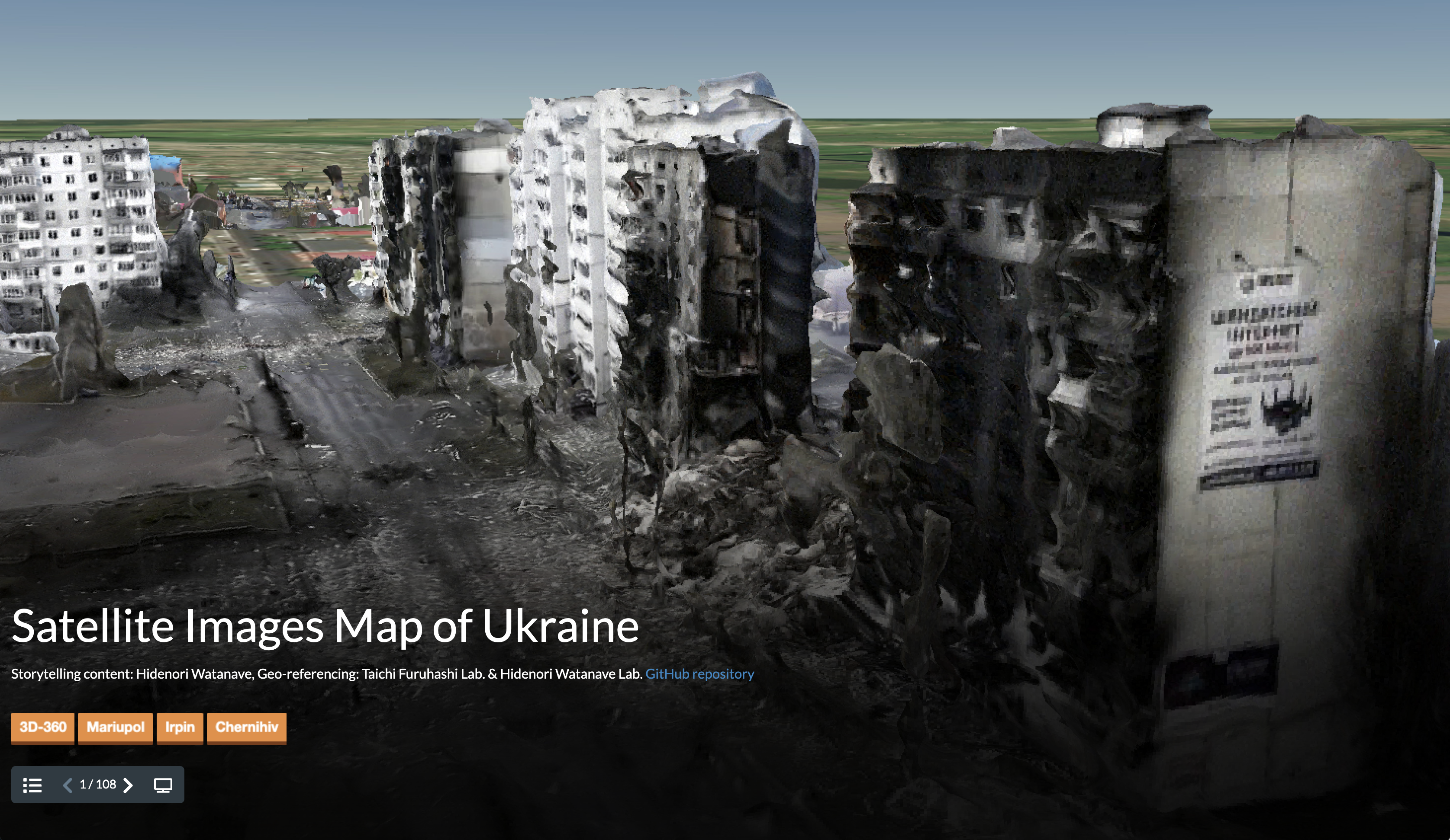
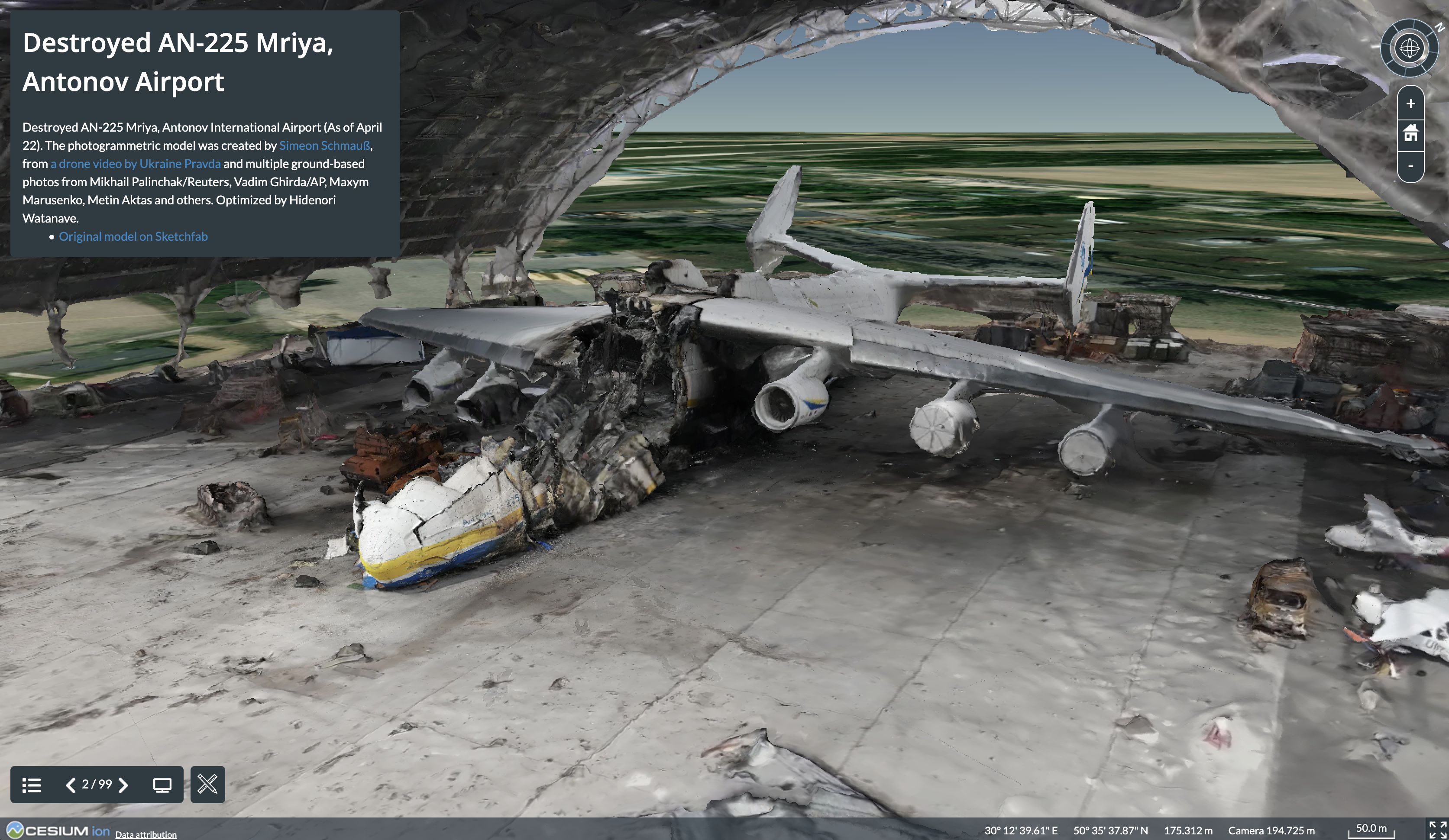
Since February 25, immediately after the start of the Russian invasion of Ukraine, we have been creating and updating digital maps covering images provided by private satellite imaging companies such as Maxar Technologies, photogrammetric images created by volunteers around the world, and multispectral images provided by NASA, ESA, and other organizations. The map is updated continuously. This is a joint project with Taichi Furuhashi Laboratory of Aoyama Gakuin University. The data is made public on GitHub as needed and is intended to be used for a wide range of applications.
Hidenori Watanave Laboratory
Hidenori Watanave Laboratory
Related links
Research collaborators
Taichi Furuhashi (Professor at Aoyama Gakuin University, Collaborative Researcher at CSIS, The University of Tokyo)
SDGs


Contact
- Email: Hidenori Watanave hwtnv[at]iii.u-tokyo.ac.jp
※[at]=@


