
Global socio-economic monitoring system using satellite data


宮崎 浩之
空間情報科学研究センター
特任助教
※教員は2024年3月当時
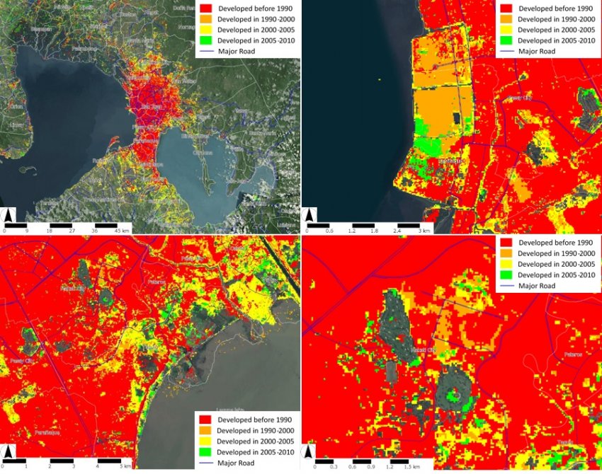
国や地域によって社会経済データの整備状況や利用可能性に大きな差があることを鑑みて、全世界を一定の条件で観測する衛星データを使った社会経済状況をモニタリングする方法を研究し、データ製品を開発する。また、国際機関等を通じて開発課題への適用を進める。具体的には、全世界の人間居住地マッピング、夜間光を用いた社会経済指標の推定、災害や経済危機の被害を観測・推定する方法の研究開発を進めている。
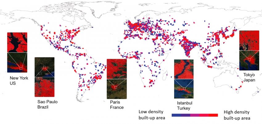
代表者による作成
代表者による作成
プロジェクトに関するURL
共同実施者
・Groups on Earth Observation (GEO) Working Groups on Global Urban Observation and Information
・Global Human Settlement (GHS) Working Group
・Global Human Settlement (GHS) Working Group
主な関連論文
・Miyazaki, H., Nagai, M. and Shibasaki, R. (2016) 'An Automated Method for Time-Series Human Settlement Mapping using Landsat Data and Existing Land Cover Maps', in 2016 IEEE International Geoscience and Remote Sensing Symposium (IGARSS), Beijing, China.
・Guo, Z., Shao, X., Xu, Y., Miyazaki, H., Ohira, W. and Shibasaki, R. (2016) 'Identification of Village Building via Google Earth Images and Supervised Machine Learning Methods', Remote Sensing, 8(4), 271.
・Miyazaki, H., Shao, X., Iwao, K. and Shibasaki, R. (2014) 'Development of a Global Built-Up Area Map Using ASTER Satellite Images and Existing GIS Data' in Global Urban Monitoring and Assessment through Earth ObservationCRC Press, 121-142.
- カテゴリナビ