


Takuya Hiroshima
Director
Ecohydrology Research Institute, The University of Tokyo Forests, Graduate School of Agricultural and Life Sciences
http://www.uf.a.u-tokyo.ac.jp/english/our_forests/ERI.html
The Ecohydrology Research Institute is one of the facilities collectively known as the “University of Tokyo Forests,” which belong to the Graduate School of Agricultural and Life Sciences. It used to be called the “University Forest in Aichi” but was renamed in 2011 to make a fresh start as a place for basic and applied research into the interactive relationships among forests, water, and human beings as well as a place for educating undergraduate and graduate students.
The Institute is situated amid the hills of eastern Owari in Aichi Prefecture. Because the Owari area has long been a production center for Japanese earthenware, a great number of trees in the local forests had been cut down to the roots to be used as firewood for making pottery. As a result, many of the forests were lost and the hills were rendered devoid of all plant life, leaving them as hageyama, or “bald hills.” Moreover, due to the geological features of the area, including the existence of weathered granite and sandy gravel layers, landslides from these “bald hills” into rivers and flooding in downstream zones subsequently increased. In response, the Aichi Prefectural Government asked the then-Tokyo Imperial University (presently the University of Tokyo) to come up with a reforestation plan for the bare hills.
Under these circumstances, Tokyo Imperial University acquired the land, a forest extending over about 1,300 hectares that had been owned by the Imperial family (presently a National Forest), in 1922. Naming the land the “University Forest in Aichi, Faculty of Agriculture,” the University’s initial aims for the land were to reforest the bare hills, observe the reforestation process over a long period of time, and collect scientific data throughout the course of these actions. The founding spirit of the forest facilities, which were established 94 years ago, has been passed down to the Ecohydrology Research Institute.
The Ecohydrology Research Institute is now mainly composed of the Goizuka Administration Office and Research Laboratory (one hectare), the Akazu Research Forest (745 hectares), and the Ananomiya Experimental Forest (77 hectares) in Seto City, along with the Inuyama Research Forest (443 hectares) in Inuyama City, Aichi Prefecture.
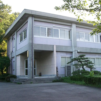 Goizuka Administration Office
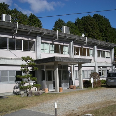 Akazu lodging facilities
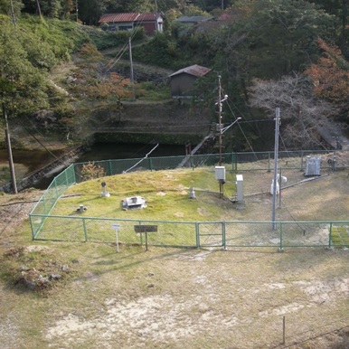 Shirasaka Meteorological Observation Station
The Goizuka Administration Office and Research Laboratory (Photo 1) serve as the main office of the Institute. These facilities are located on a small hill in the center of Seto City and are adjacent to a residential area. Trees on the premises are therefore managed with great care to avoid causing any problems for the neighbors, such as those related to fallen trees, plant diseases and damage caused by insect pests.
The Akazu Research Forest is situated in the suburbs. You can get there in 10 minutes by car from Owari Seto Station on Meitetsu’s Seto Line. The Forest’s lodging facilities (Photo 2) can accommodate up to 30 people and include lecture rooms. In front of these accommodation facilities is the Shirasaka Meteorological Observation Station (Photo 3), where precipitation, air temperature, soil temperature, humidity, wind velocity and other data have been recorded since 1929.
The Akazu Research Forest is situated in the suburbs. You can get there in 10 minutes by car from Owari Seto Station on Meitetsu’s Seto Line. The Forest’s lodging facilities (Photo 2) can accommodate up to 30 people and include lecture rooms. In front of these accommodation facilities is the Shirasaka Meteorological Observation Station (Photo 3), where precipitation, air temperature, soil temperature, humidity, wind velocity and other data have been recorded since 1929.
 Shirasaka Flow Measuring Weir
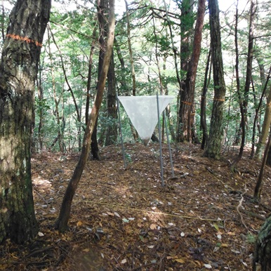 Shirasaka plot for long-term ecological research
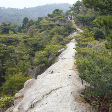 Ridge with exposed and weathered granite
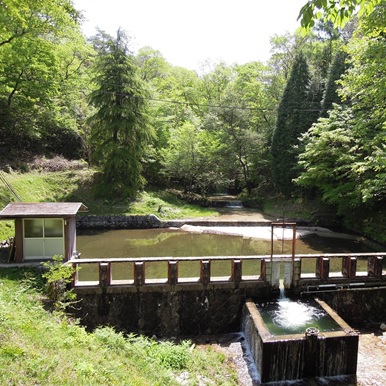
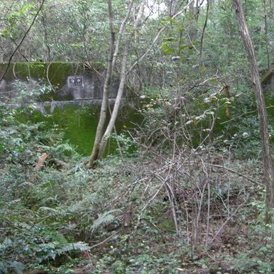
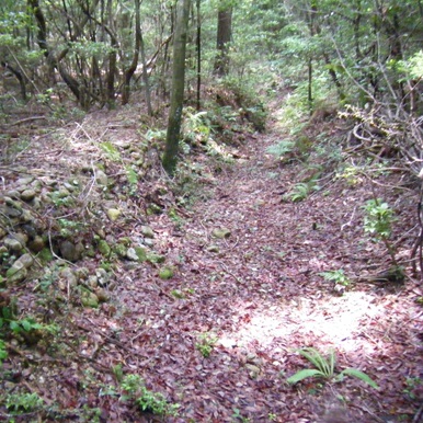
Further south of and adjacent to this observation station, the Shirasaka Flow Measuring Weir (Photo 4) has also been continuously collecting data since its installment in 1929. The weir measures the amount of river water flowing out from the catchment area that extends over 89 hectares at the northern foot of Mt. Sanage (690 meters high). These two measurement facilities have long provided data on precipitation, outflow, and water loss (through evaporation and flows underground). In the natural forest area of the Akazu Research Forest, long-term ecological research plots (Photo 5) were established in order to examine changes in forest vegetation. The land in this area has been divided into several 10-square-meter plots, and the identification of individual trees, measurement of trunk diameters, and collection of fallen seeds within each plot are regularly conducted. Nowadays, the whole Akazu Research Forest area is thoroughly covered by trees, but you can still find traces of the “bald hills” that used to exist in the area (Photo 6). There also was a pottery kiln in these hills used during the Muromachi period, and its remains (Photo 7) are designated as a national historic site.
The Ananomiya Experimental Forest is 10 minutes from the Goizuka Administration Office by car, and has the oldest measuring weir of the Ecohydrology Research Institute (Photo 8), where outflows of water have been measured since 1925.
The Ananomiya Experimental Forest is 10 minutes from the Goizuka Administration Office by car, and has the oldest measuring weir of the Ecohydrology Research Institute (Photo 8), where outflows of water have been measured since 1925.
 Remains of the Konagaso pottery kiln
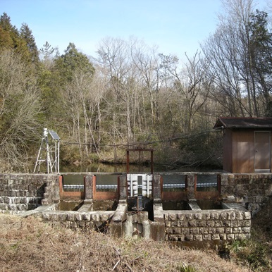 Ananomiya Flow Measuring Weir
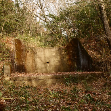 Earth dike (with a flood control channel made from concrete)
The Inuyama Research Forest is located in the suburbs, taking about an hour to reach by car from the Goizuka Administration Office. A range of soil erosion control and greening projects have been implemented in the Forest area since the early Showa period (1926-1989) to reforest the bare hills. One distinctive example of a soil erosion control mechanism established in this Forest is an earth dike (Photo 9). Equipped with a flood control channel made from concrete, the pictured dike was established in around 1929 by Dr. Kitaro Moroto of Tokyo Imperial University and has high historical value.
 Concrete dike
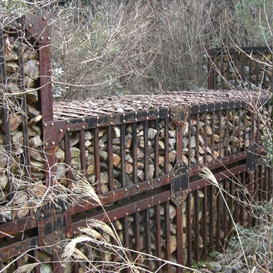 Flexible steel-framed dike
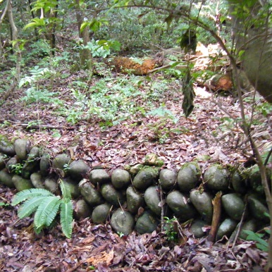 Tanidomeko work done using the river rock dry stack masonry method
More modern structures include a concrete dike (Photo 10) and a flexible steel-framed dike (Photo 11), both constructed by Aichi Prefecture in 1978 as part of reforestation work. Further, there are remains of other soil erosion control works across the Inuyama Research Forest, including tanidomeko (check dam) work to stabilize water flows and sediments in valley channels (Photo 12), as well as ryuroko (channel consolidation) (Photo 13) and tokogatameko (groundsill) (Photo 14) work to stabilize riverbanks and riverbeds. On hillsides in the Forest area, you can also see the remains of greening works called “norikiriko” (slope cutting) and “sujiko” (horizontal steps), though they are not clearly visible. Reforestation efforts in the Inuyama Research Forest, just as with the Akazu Research Forest, have been successful. At present, various studies pertaining to ecohydrology are being conducted at the Forests, including, for instance, the use of an experimental facility called a “lysimeter” (Photo 15) to research the impact that differences in vegetation have on water flows.
 Remains of ryuroko work
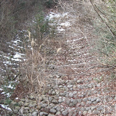 Tokogatameko work reinforced by wire gabions
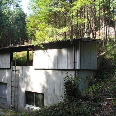 A lysimeter
* For a tour of the Institute’s Research Forests or use of the facilities, you need to take out insurance and submit the required documents to obtain approval.
**This article was originally printed in Tansei 34 (Japanese language only). All information in this article is as of March 2017.
**This article was originally printed in Tansei 34 (Japanese language only). All information in this article is as of March 2017.
 - Tansei 19 -


